Geophysics
Seismic interpretation is one of the most powerful tools available to geoscientists in the pursuit of hydrocarbons.
Overview
Seismic interpretation is one of the most powerful tools available to geoscientists in the pursuit of hydrocarbon exploration and development. The usefulness of the increased subsurface resolution cannot be overstated. Seismic volumes greatly enhance the clarity of the subsurface structure and help pinpoint structural highs and faults that offset specific horizons. Establishing the fault framework within a field yields insight into reservoir compartmentalization and guides proper field development.
Seismic reflections are created by contrasting rock properties across a boundary. Changes in rock characteristics, such as density and velocity, affect both the amplitude and phase of the wavelet measured at the surface. Differences in the recorded seismic signal can be leveraged to help understand changes in the subsurface (e.g. facies change). Establishing relevant relationships between well logs and seismic data allows the full value of the seismic data to be extracted.
We can apply our seismic interpretation experience to help high-grade acreage and identify the optimum locations to maximize production and minimize geologic risk.
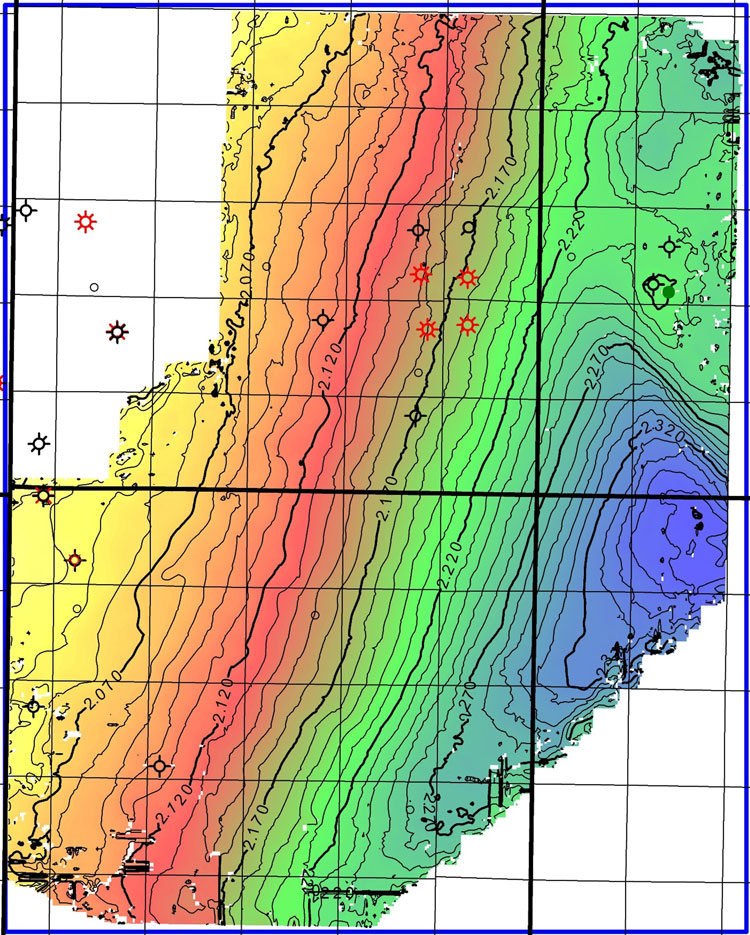
Time structure map of the Frontier Formation in Wyoming within a 3D seismic survey. The additional resolution provided by the 3D survey allows subtle structural influences on productivity to be determined.
Full Geophysics Skillset
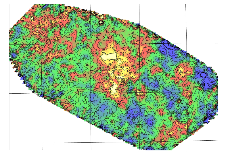
Simple amplitude map of a sandstone oil reservoir. When sufficient well logs are present within a 3D volume, seismic attributes can sometimes help characterize lithologic changes in the reservoir. This provides immense value to the operator as wells are placed in their ideal locations with the desired lithology.
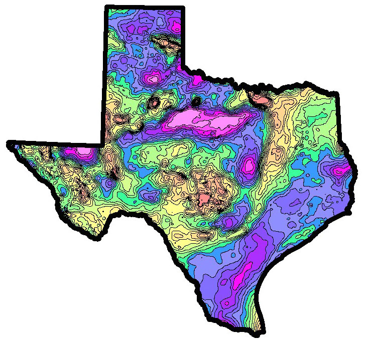
Texas Isostatic Gravity Map illustrates major structural features at a regional scale
Data management
- Properly import both 2D and 3D seismic volumes into Kingdom or another software platform
Synthetic Construction and Horizon Generation/Propagation
- Gather sonic logs and generate synthetic seismograms to effectively link the seismic section to formation tops
- Generate formation horizons and extrapolate across the available seismic volume
Structural Analysis
- Interpret faults that offset horizons throughout the seismic section
- Utilize fault geometries to understand stress regimes throughout the section
- Identify and constrain the timing of deformation
- Calculate isochrons to characterize changes in accommodation space through geologic time
- Apply specific datasets to help with accurate fault interpretation (i.e. coherency volumes)
- Calculate curvature grids to identify areas of enhanced fracturing
Waveform Analysis
- Leverage seismic amplitude attributes such as envelope and phase to interpret lithologic and thickness changes
- Utilize frequency analysis to help identify potential gas-bearing intervals
Risk Mitigation
- Identify areas of higher risk such as a fault along a planned horizontal or compartmentalized blocks that could increase cost and lower economic returns
- Harness waveform signatures to predict the presence or absence of the target reservoir
Potential Field Analysis
- Incorporate gravity and magnetic data to help identify basement faults, intrusive bodies, and regional uplifts
Time to Depth Conversion
- Use formation tops and time surfaces/isochrons to calculate interval velocities. Combine these to generate a velocity model to convert from the time domain to the depth domain
Ideal Location Placement
- Leverage all the above datasets and workflows to provide the ideal location for optimum hydrocarbon production
Contact
We look forward to working on your next project.
Moosetooth Geological Consulting, LLC
6547 S. Dexter Street
Centennial, CO 80121
(303) 501-2571
maurits.thayer@moosetoothgeo.com