Data Management
Data is the foundation of technical analysis in the energy sector.
Overview
Data is the foundation of technical analysis in the energy sector. Companies make multimillion dollar decisions based on data. It needs to be complete and accurate.
Intimately working with geological, geophysical, petrophysical, and production data for 20 years has given Moosetooth the experience necessary to apply datasets to their full effectiveness. We have the ability to build a project from scratch in the major geoscience software platforms. We utilize public datasets from state oil and gas commission websites as well as private sources.
There is no need to hire a separate vendor for geotechnical workflows. Moosetooth can handle the needed processes to get the data into a manageable format for proper evaluation. We are a one-stop shop.
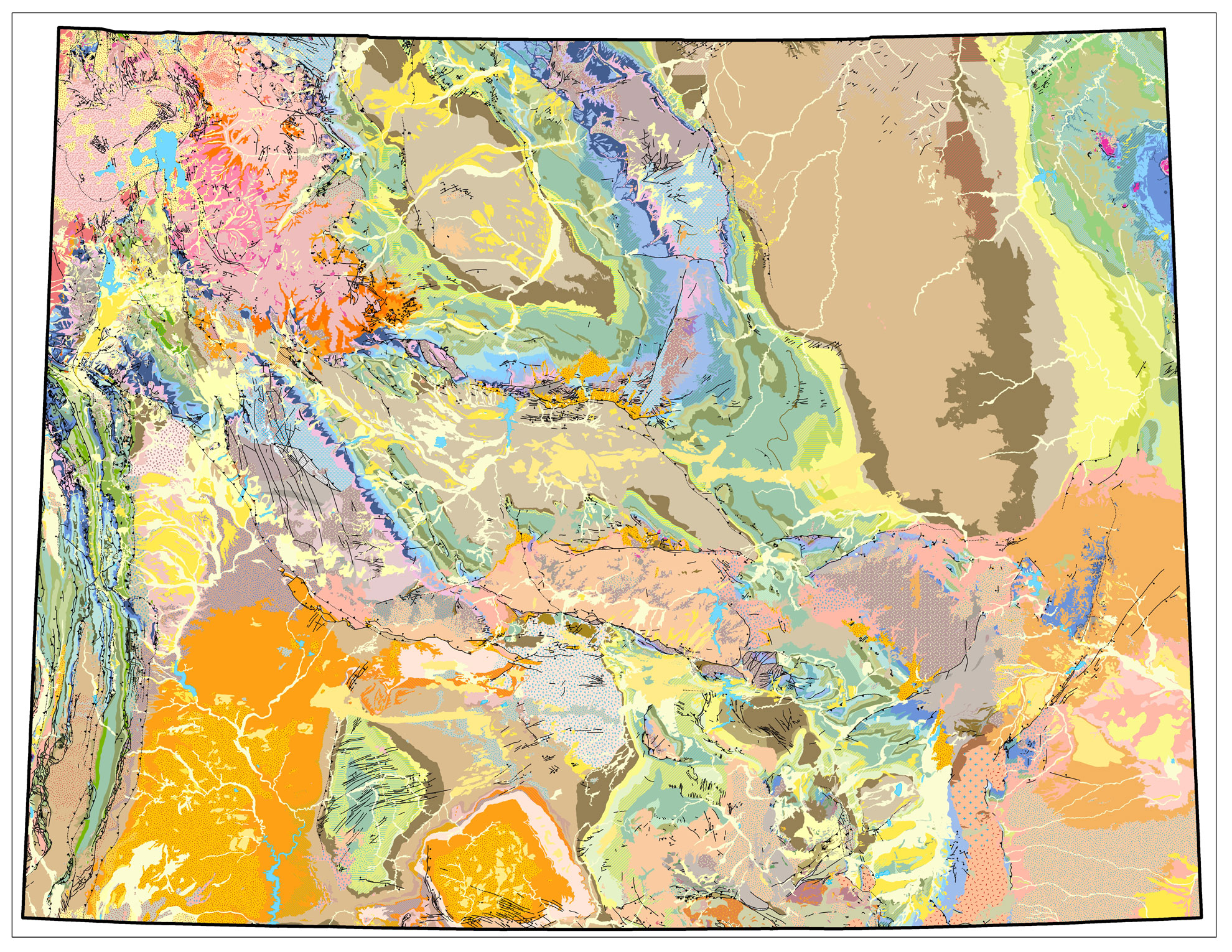
Wyoming State Geologic Map. This digital ArcGIS dataset obtained from a public state source illustrates the plethora of available data within the ArcGIS format.
Full Data Management Skillset
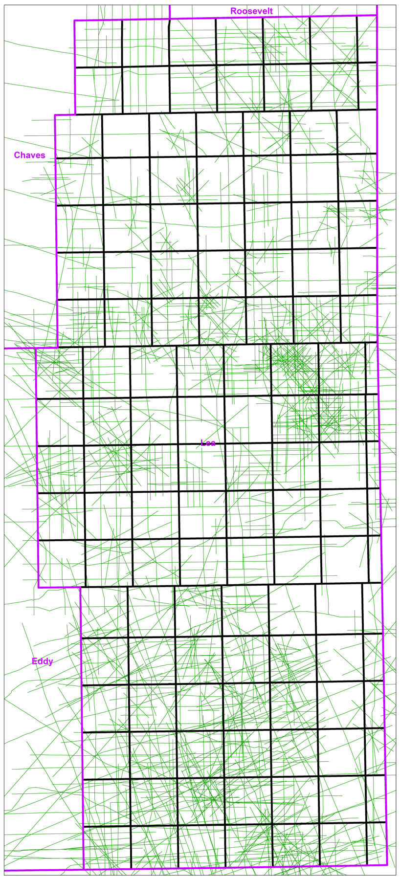
Map of 2D seismic line coverage in Lea County, NM. Each individual line above represents a separate 2D seismic line. Available seismic data over a prospect area can be quickly ascertained.
Petra Skillset
- Build Petra projects from scratch by leveraging public datasets or private sources
- Apply coordinate system changes for well data and/or grid data.
- Generate wells and import subsequent well data through ASCII or IHS functionality
- Import/export both digital and raster logs
- Digitize raster logs into LAS format for petrophysical applications
- Import/export production data into decline curve analysis software and economic models
- Grid to grid calculations such as interval velocities for time to depth conversion
Arc GIS Skills
- Import shapefiles from public sources. Adjust shapefiles in ArcGIS and export built for purpose shapefiles for use in other software platforms
- Utilize vast sources of public information such as geologic maps available through ArcGIS software
Corpscon Ability
- Leverage this powerful software to convert data from one coordinate system to another for point or grid data to appropriately transfer data between projects of differing coordinate systems
Kingdom
- Build Kingdom projects from scratch utilizing public data sources for culture and well population
- Import segy files (2D lines and 3D surveys) into Kingdom and QC location data
- Import/export well data into Kingdom from ASCII spreadsheet
- Import, export, and manage cultural shapefiles in Kingdom for basemap
- Import, export, and manage digital log files (LAS)
- Export grid data such for use in other platforms
Other
- Leverage relational database functionality and large spreadsheets through Access software
- Harness the power of Excel and advanced formula functionality to get dataset into the appropriate format
- Petrel geomodeling experience
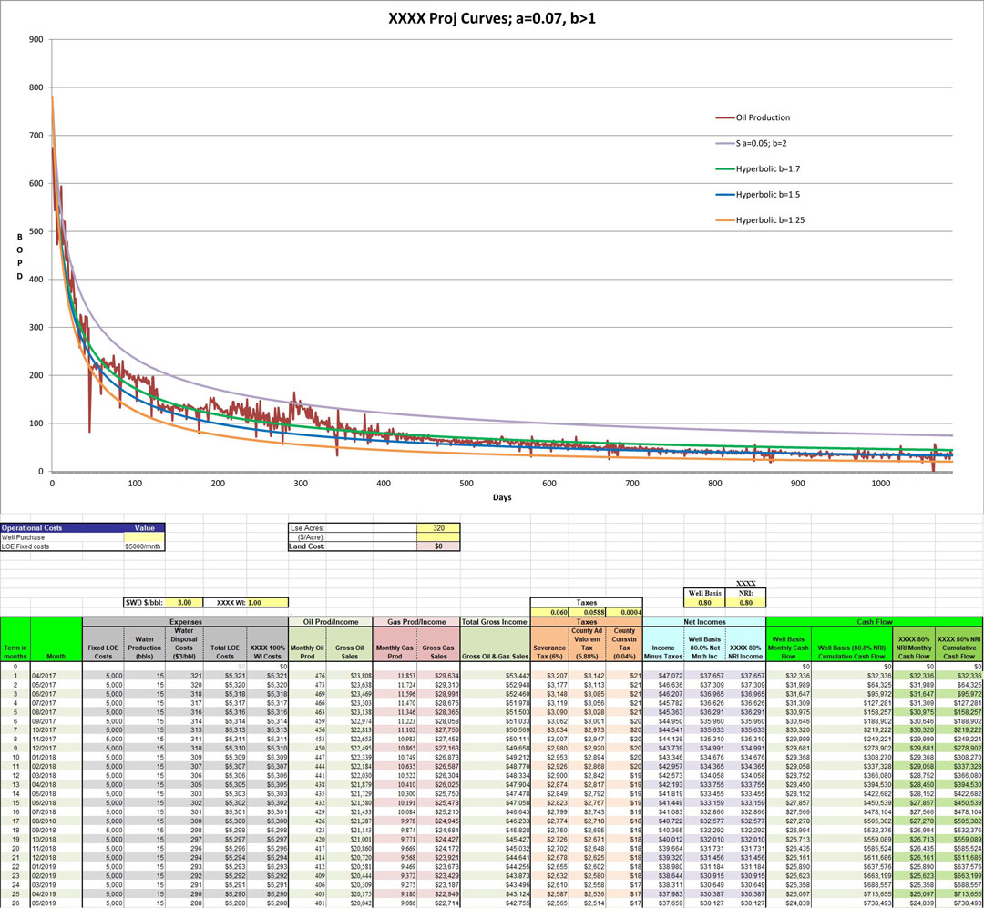
At top, a decline curve showing actual oil production and modeled hyperbolic curves. Using the best fit hyperbolic curve based on Arps equations allows future prediction of production to be made. An economic model shown below incorporates that projected production along with forecasted prices, taxes, and expenses to quantify the economic value of a project.
Contact
We look forward to working on your next project.
Moosetooth Geological Consulting, LLC
6547 S. Dexter Street
Centennial, CO 80121
(303) 501-2571
maurits.thayer@moosetoothgeo.com